WAVELETS IN THE FORECAST VERIFICATION OF AN ASSIMILATION EXPERIMENT
IN THE LIGURIAN SEA.
Alvera-Azcįrate A.
1*
, Barth A.
1
, Ben Bouallčgue Z.
1
, Vandenbulke L.
1
, Rixen M.
2
and Beckers J.M.
1
1
G.H.E.R. University of Ličge, Belgium - *A.AlveraAzcarate@ulg.ac.be
2
SACLANT Undersea Research Centre, Italy
Abstract
The skill assessment of an assimilation experiment is presented. A 2D wavelet decomposition is used to decompose the model results and
the observations into different spatial scales. This allows to establish the error between the model and the observations at those different
spatial scales, and to identify the scale where the error is higher. At each scale, classical error measurements are applied, such as RMS.
Special attention is paid to the land-sea boundaries, as they affect the wavelet analysis.
Keywords: Forecast Verification, Wavelets, Ligurian Sea.
Rapp. Comm. int. Mer Médit., 37,2004
81
The GHER 3D primitive equation model has been implemented in the
Ligurian Sea in a two-way nested approach. A reduced order, optimal
interpolation data assimilation scheme has been used for an
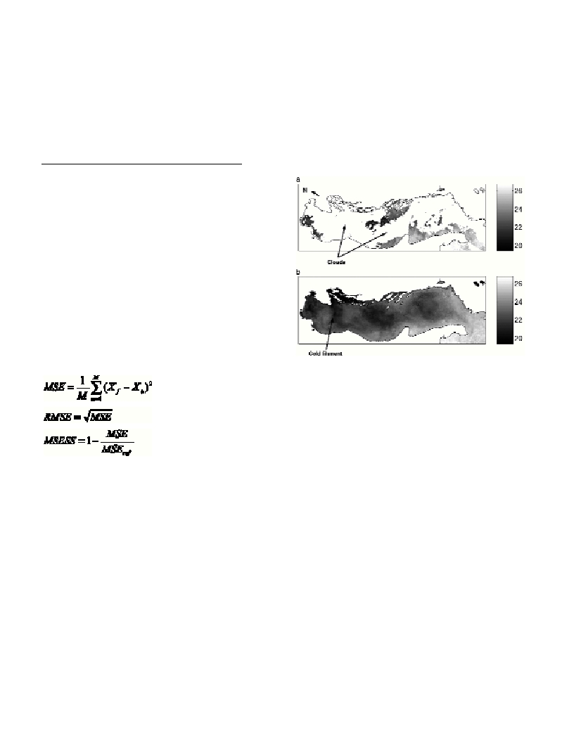
assimilation experiment. Sea Surface Temperature (SST), Sea Surface
Height (SSH) and CTD profiles are assimilated to realize the forecast
[1]. This work presents the analysis of the results obtained by the
model, in order to establish the benefits of the assimilation.
For the skill assessment of the model, a 2D wavelet decomposition is
made [2, 3], in order to realize a multiresolution analysis of the results
obtained. Wavelet Transforms are capable of localizing the signal
variability simultaneously in both time and scale, something that
Fourier Transforms, for example, are not able to do. The wavelet
analysis allows to decompose the model and the observations into
different spatial scales, ranging from ~1 km (the spatial scale of the
model) to 128 km. At each scale, the model is compared to the
observations, and the error is established. The scale where the highest
errors are found can be identified, and studied in more detail, to find
the causes of the error. The wavelet decomposition allows thus to
make an analysis of the model results in a more detailed way. At each
scale, the Root Mean Square (RMS) error and the Mean Square Skill
Score (MSESS) are calculated. They can be derived from the Mean
Square Error (MSE) [4]:
[1]
[2]
[3]
where Xoare the observations, Xfthe model forecast at the
observation points, and MSE
ref
is the MSE calculated between the
reference system and the observations. The RMS allows to establish
the error between the model and the observations, and the MSESS
measures the improvement of the model in relation to a reference
system. There are several possibilities for the reference system, as
climatology, the persistence forecast, or an output of an ancient
version of the model. In this work we have used a free model run of
the model to test its improvement.
The wavelet analysis presents a limitation when dealing with
oceanographic data sets. They present often irregular land-sea
boundaries. The wavelet will be affected by the boundaries and the
result of the decomposition will show a high perturbation at the coast.
This effect may be diminished by, first, a good choice of the mother
wavelet, and second, a smooth passage between the sea and the earth.
The wavelet chosen for this work is the Haar wavelet, as its support
width is 1, while the other wavelets have higher support width, as for
example the Daubechies wavelet family, with a support width of 2N-
1, with N the order of the wavelet. The small support of the Haar
wavelet may help to reduce the effects at boundaries. High support
wavelets “feel” the boundary earlier than small support wavelets.
The smooth passage between the land and the sea consists in a
diffusion of the sea values towards the land values, such that the limit
between them is less abrupt. This smoothing decreases the noise of the
wavelet amplitudes at the boundaries.
The boundaries approach in the wavelet decomposition, as well as the
analysis of the assimilation experiment results will be presented.
References
[1] Barth, A., Alvera-Azcįrate, A., Beckers, J.M., Rixen, M., Vandenbulke,
L. and Ben Bouallegue, Z. 2003. Data Assimilation in a two-way nested
model of the Ligurian Sea (this issue).
[2] Briggs, W.M. and Levine, R.A. 1997. Wavelets and Field Forecast
Verification. Monthly Weather Review, 125: 1329-1341.
[3] Daubechies, I. 1992. Ten lectures on wavelets. SIAM. 357 p.
[4] Jolliffe, I.T. and Stephenson, D.B. 2003. Forecast Verification. A
practitioner’s guide in Atmospheric sciences. Wiley. 240 p.