Rapp. Comm. int. Mer MÚdit., 37,2004
160
THE MEDITERRANEAN MARINE FORECASTING SYSTEM: STATUS OF IMPLEMENTATION
Nadia Pinardi, Giovanni Coppini and MFSTEP partners
Istituto Nazionale di Geofisica e Vulcanologia, Via D. Creti, 12, Bologna I-40100, Italy
n.pinardi@ambra.unibo.it, coppini@bo.ingv.it
Abstract
The Mediterranean ocean Forecasting System (MFS) has started operational activities in January 2000. Presently it produces daily analyses
and weekly 10-days forecasts of currents and temperature and salinity fields for the entire Mediterranean at approximately 10 km
resolution. The main elements of the MFS - simultaneously operating in near real time the observational data network, a general circulation
model and the data assimilation scheme- were implemented as part of an EU funded project called Mediterranean Forecasting System Pilot
Project (MFSPP, IV Framework Program). The second phase will be undertaken by another EU funded project, called the Mediterranean
ocean Forecasting System: Toward Environmental Predictions (MFSTEP, V Framework Program), which is seeking further consolidation
and expansion of the MFS.
Keywords: Mediterranean Sea, Ocean forecasts, Operational oceanography.
Results and future developments
MFSPP (1) lasted 3 years and ended in 2002 and achieved the
following goals: 1) the first basin scale real time observing system
was set up and operated with satellite, VOS-XBT (2) and moored
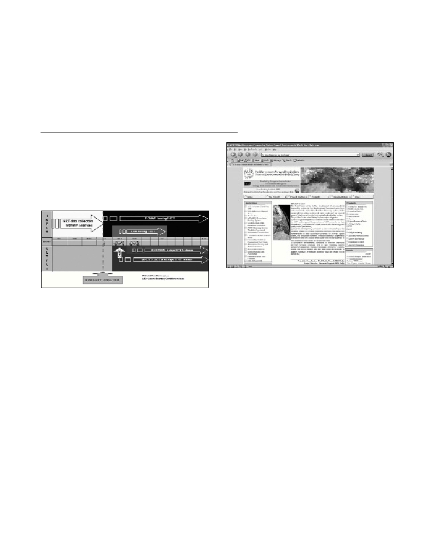
buoys (3) observations; 2) the real time forecasting system (Fig. 1)
assimilated all these observations and produced a 10 days forecast
every week; 3) regional and shelf models were nested and calibrated
within the MFS basin scale model; 4) biochemical ?ux models were
calibrated and validated with data assimilation components for several
open ocean and shelf areas in the Mediterranean.
Fig. 1. The MFS weekly information ?ow for forecasting. The forecast
starts every week at 12:00 fo Tuesday from an analysis/nowcast produced
from data collected in the previous week. The basin scale forecast is
done with ECMWF forcing and on Wednesday the initial and lateral
boundary conditions are given to limited areas models, nested within the
MFS OGCM.
The main goal of MFSTEP, that it is funded to run from March 1,
2003 for three years, is to advance the present monitoring system, to
demonstrate practical feasibility of regional and shelf predictions in
several Mediterranean sub-regions (at 3 km resolution), to further
develop the ecosystem modelling and to start the development of end-
users interfaces for the exploitation of project results.
In particularly MFSTEP has six major scientific/technological
objectives:
OBJ1.Improve and expand the existing Near Real Time large scale
monitoring system;
OBJ2.Add new observing system components in terms of
biochemical measurements and new automated technology;
OBJ3.Improve the 10 days basin scale ocean forecast system (6.5
km resolution) and demonstrate the feasibility of Near Real Time
three days forecasts in different regional areas (3 km resolution);
OBJ4.Develop the asynchronous ocean-atmosphere coupling with
high resolution atmospheric forcing over regional areas;
OBJ5.Implement the three dimensional ecosystem models coupled
to the forecasting system for future predictions of biochemical ?uxes
and state variables;
OBJ6.Consolidate the dissemination of forecast products to a wide
user community and develop applications with end-users
The Mediterranean Forecasting System is presently operational and
its products are available on MFSTEP central website:
www.bo.ingv.it/mfstep (Fig. 2)
Fig. 2. MFSTEP central website.
References
1-Pinardi N., Allen I., Demirov E., De Mey P., Korres G., Lascaratos A.,
Le Traon P.-Y., Maillard C., Manzella G., and Tziavos C., 2003. The
Mediterranean ocean forecasting system: first phase of implementation
(1998û2001).Annales Geophysica, 21, 1: 3-20.
2-Manzella G. M. R., Scoccimarro E., Pinardi N., and Tonani M., 2003.
Improved near real-time data management procedures for the
Mediterranean ocean Forecasting System-Voluntary Observing Ship
program. Annales Geophysica, 21, 1: 49-62.
3-Nittis K., Tziavos C., Thanos I., Drakopoulos P., Cardin V., Gacic M.,
Petihakis G., and Basana R., 2003. The Mediterranean Moored Multi-
sensor Array (M3A): system development and initial results. Annales
Geophysica, 21: 1, 75-87.